


 Trending
When the Lagos-Calabar Coastal Highway was announced, I said the proposed road would not reach Calabar along the route presented to Nigerians. Anyone who has travelled extensively through the creeks of the Niger Delta would understand why.
The problem was not the ambition to connect Lagos to Calabar. It was the assumption that a continuous coastal highway through some of the country’s most difficult terrain was the most sensible way to achieve it.
Now that the possibility of routing the highway through the existing East-West Road, from Ondo into Edo and through the Niger Delta, has entered the conversation, a fundamental question arises: why was this not the starting point?
Read More : Video: Musk Launches New Tesla Flying Car
This is not an argument against infrastructure. It is an argument for thinking carefully about what we build, where we build it and how much we are willing to spend to achieve the same objective through a different route.
Nigeria does not lack grand ideas. What we often lack is the discipline to subject those ideas to rigorous technical scrutiny before turning them into expensive political commitments.
The Niger Delta is not a line on a map
Anyone who has spent considerable time navigating the creeks of Delta and Bayelsa States understands that the Niger Delta is not a conventional coastal landscape. Much of it consists of swamps, estuaries, waterways and scattered settlements, with difficult ground conditions and an intricate relationship between land, freshwater and the sea.
A line drawn on a map can look deceptively simple. Turning that line into a dependable highway is an entirely different undertaking. Engineers must contend with soil conditions, drainage, flooding, environmental sensitivity, oil and gas infrastructure, pipeline rights-of-way and the cost of connecting settlements separated by substantial waterways.
At some point, the question stops being whether engineers can construct a road through difficult terrain. Engineers can achieve extraordinary things. The more important question is whether Nigeria should undertake that expense when an existing transport corridor offers a potentially more practical alternative.
The original coastal alignment deserved much tougher scrutiny on these grounds. Before committing to a project of this scale, the government should have compared the available routes, construction costs, environmental consequences, maintenance obligations and expected economic benefits.
Ambition is not a substitute for due diligence. And a project being technically possible does not automatically make it economically sensible.
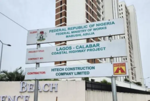
Fix the roads people already use
My argument has never been that Nigeria should abandon the ambition of connecting Lagos to Calabar. It is that we should be more deliberate about how we achieve it.
We already have a transport corridor linking important population centres and commercial hubs across the South-West and South-South. The Shagamu-Benin Expressway, the East-West Road through Effurun and Warri, the stretches towards Ahoada and Elele, and the road from Port Harcourt to Calabar form part of a network that deserves serious, coordinated investment.
Rather than treat these roads as separate rehabilitation projects while pursuing an entirely new coastal alignment, the government should examine what it would cost to bring the existing corridor to a dependable highway standard, correct its flood vulnerabilities and improve connections between major economic centres.
The economic logic is straightforward. Existing roads already serve established settlements, businesses, markets and commercial traffic. Upgrading them could strengthen connectivity while reducing the need for extensive new land acquisition and environmental disturbance along a fresh route through difficult terrain.
Of course, the East-West Road cannot simply be adopted as an alternative and left in its present condition. Its drainage problems, pavement failures, flood-prone sections and other structural weaknesses must be addressed. Otherwise, Nigeria would merely transfer the problem from one alignment to another.
The government should publish a credible comparison of both options, covering construction and maintenance costs, travel times, freight movement, environmental impacts and the number of people likely to benefit. Let the evidence determine the route.
Connect the communities, not just the map
Another point often gets lost in these arguments. The Niger Delta’s coastal communities need infrastructure, but that does not mean every community needs a single continuous highway along the coastline.
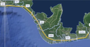
The same principle applies to Burutu, where improved transport links could open economic opportunities and make access to essential services easier.
There is also the practical question of basic services. Fuel is expensive in remote communities where supplies must be transported by boat. Freshwater can be difficult to obtain in places surrounded by saline waterways. Properly designed fuel distribution facilities and freshwater infrastructure, including desalination where it makes economic sense, could tangibly improve daily life.
These are not substitutes for a national highway. They are separate infrastructure needs that deserve assessment on their own merits.
The mistake would be to assume that one spectacular project can solve every connectivity problem in the Niger Delta. A national corridor should connect major centres efficiently. Local bridges and feeder roads should connect communities to markets, healthcare, education and essential services.
Good infrastructure planning begins by asking what people need, where they need it and the most economical way to provide it.