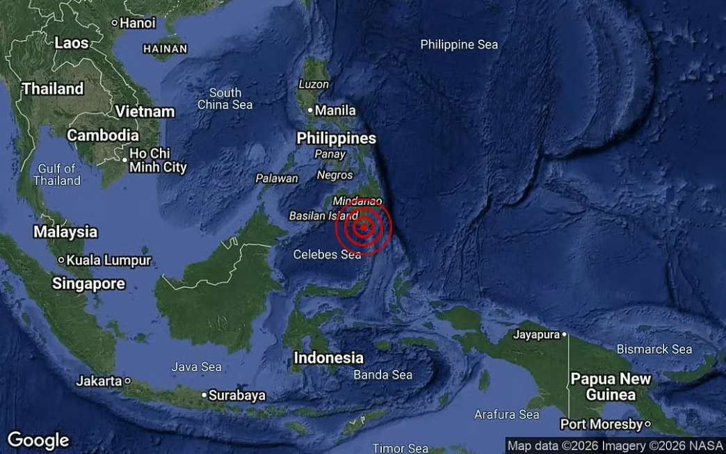
The offshore quake hit at a depth of 35km off the island of Mindanao. (MetMalaysia pic)
A magnitude 7.8 earthquake struck off the southern coast of the Philippines on Monday, the United States Geological Survey said, triggering concern across the region and prompting a tsunami alert from a regional warning centre.
The United States Geological Survey said the offshore quake struck at a depth of 35 kilometres off the island of Mindanao. The shallow depth and offshore location raised immediate concern among seismologists and emergency agencies monitoring seismic activity in the Pacific region.
7.8-Magnitude Quake Strikes Off Philippines Credit: FMT
Following the event, the Pacific Tsunami Warning Centre issued a notice warning that tsunami waves were possible “within the next three hours” along several coastal areas. The advisory covered the Philippines, Indonesia, Palau, Taiwan and Papua New Guinea, reflecting the wide reach of potential wave activity across the western Pacific basin.
Advertisement
Authorities in the affected regions began monitoring sea levels and coastal conditions while assessing the possible impact of the quake. Emergency services and disaster response agencies remained on alert as they tracked developments and prepared precautionary measures for communities located near the shoreline.
The earthquake adds to the region’s history of seismic activity, as the Philippines lies along the Pacific “Ring of Fire”, a zone known for frequent earthquakes and volcanic eruptions. Officials continue to gather data on the tremor as aftershock risks and tsunami developments remain under close observation.
Toyibat is a highly motivated Mass Communication major and results-oriented professional with a robust foundation in media, education, and communication. Leveraging years of hands-on experience in journalism, she has honed her ability to craft compelling narratives, conduct thorough research, and deliver accurate and engaging content that resonates with diverse audiences.
Weekly roundups. Sharp analysis. Zero noise. The NewsCentral TV Newsletter delivers the headlines that matter—straight to your inbox, keeping you updated regularly.


 Trending