


 Trending
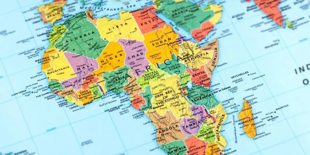
An African-led campaign to correct how Africa is represented on world maps has won UN backing, with 164 countries supporting a Togo-sponsored resolution calling for more accurate map projections.
The 164-1-6 vote encourages governments, schools, international organisations and technology platforms to use equal-area projections such as Equal Earth when representing the relative size of continents.
Togo’s Foreign Minister Robert Dussey, who introduced the resolution on behalf of the African Group, told the General Assembly that maps influence how people understand the world.
“Maps shape our understanding of the world,” Dussey said. “They guide education, nourish the imagination, and influence collective perceptions.”
The resolution, titled “Correct the Map: Rebalancing Global Cartographic Representation and Promoting Equitable Representation of the World’s Regions, Particularly Africa,” was adopted on September 4 after 164 countries voted in favour. Six abstained, and the United States was the only country to vote against.
The result gives a campaign led by Africa No Filter and Speak Up Africa an international endorsement that began outside government and diplomatic institutions.
The Mercator projection, created by Gerardus Mercator in 1569, was designed primarily for navigation. It preserves direction but increasingly enlarges landmasses as they move away from the Equator.
Africa covers about 30.37 million square kilometres. Greenland covers about 2.17 million square kilometres. Africa is therefore about 14 times larger, even though the two can appear much closer in size on a Mercator world map.
Equal Earth takes a different approach. It is an equal-area projection, meaning it preserves the relative surface areas of continents rather than preserving navigation-friendly directions.
The resolution does not ban Mercator.
Dussey made that clear during the debate, saying the text does not “condemn any projection, nor even the Mercator projection, whose historical usefulness for navigation remains undeniable.”
Nor does it require every country to adopt Equal Earth.
“The draft resolution does not impose any single projection for all uses,” Dussey said.
Instead, it encourages projections that preserve the relative size of continental land areas, particularly for education, information and other uses where area matters.
That distinction helped the proposal secure support from countries that nevertheless had concerns about how some Equal Earth maps depict national borders.
Russia voted in favour and described the initiative as an effort to address an imbalance reinforced by decades of exposure to the Mercator projection.
“The Mercator projection is widely used in education, in the media, in reference materials, and in other areas,” Russia’s representative told the assembly.
“This has cemented a visual notion about the relative sizes of various parts of the world, and this notion does not correspond to their actual surface area.”
Russia also linked the campaign to Africa’s effort to address the legacy of colonialism, arguing that the continent’s disproportionate visual representation had become part of a wider system in which “Africa’s place and significance is diminished.”
The Russian representative also stressed that the initiative came from African states themselves.
“We respect in particular the fact that this initiative is coming from the states of Africa themselves,” the representative said.
That African ownership is central to the campaign.
Africa No Filter Executive Director Moky Makura said the vote showed that a representation accepted for generations could be challenged.
“164 countries have agreed: it is time to correct the map,” Makura said in a statement following the vote.
She said the campaign began with a broader question about narratives often accepted without scrutiny.
“Now the real work begins,” Makura said. “We want to see accurate maps in schools, textbooks, newsrooms, businesses and on the digital platforms billions of people use every day.”
The campaign’s next phase will therefore be measured by what institutions do with it.
The resolution encourages member states to adopt and disseminate equal-area projections in educational, administrative and digital tools. It also calls for critical cartographic education in schools and stronger national geospatial capacity, particularly in developing countries. It asks international and regional organisations to strengthen cooperation on geospatial standards and support research and innovation around map projections.
Technology companies and digital platforms are encouraged to engage with governments and regional organisations on more accurate geographic representation. That takes the campaign into systems that determine what people see in classrooms, textbooks, news reports and digital products.
The African Union had already moved in this direction before the UN vote. The campaign gained formal continental backing in 2025, while the AU adopted Equal Earth as its preferred institutional projection in 2026, according to material supplied by the campaign.
Togo then took the issue to the General Assembly on behalf of the African Group.
Dussey presented the resolution as part of a wider effort to change how geographical knowledge is produced and transmitted.
“Correcting the map means thinking about the way in which knowledge is produced, the way knowledge is transmitted and visualized,” he said.
The campaign has also found expression outside policy. On September 4, 2025, one year before the UN vote, Brand Africa unveiled “Africa Re-Union”, a three-by-two-metre painting using the Equal Earth projection at FNB Art Joburg in South Africa.
Brand Africa founder and chairman Thebe Ikalafeng conceived the work, with intellectual input from Professor Kwesi DLS Prah and execution by South African artist Mark Modimola.
The painting removed national borders and inverted the familiar world order.
“The Africa Re-Union is not a return to the 1884 Berlin Conference table,” Ikalafeng said when the work was unveiled. “It is the setting of our own table: equal, sovereign, and unapologetically African.”
The work was later housed at the Unisa Art Gallery in Pretoria.
After the UN vote, Ikalafeng linked the decision to the campaign’s wider objective of giving Africans greater influence over how the continent is represented.
“This is a moment where Africa took the initiative to correct the wrong,” he said. “This is African agency in practice.”
He added: “The vote is the symbol. What we do next, in the classroom, on the shelf, in the boardroom, is the substance.”
That next step has already begun outside Africa.
France, which co-sponsored the resolution, announced on September 4 that it would move away from Mercator in its official representation of the world and use map representations suited to particular purposes, including the Eckert IV projection.
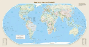
Eckert IV, like Equal Earth, is an equal-area projection. France’s move therefore provides an early example of a country changing its official cartographic practice while choosing a projection other than the one the Correct the Map campaign promotes most prominently.
Togo has also said it will update its school geography materials by the end of 2026.
Those changes will offer an early test of whether the UN vote produces changes in the maps people actually encounter. The vote itself was not without resistance.
The United States rejected the resolution, with its representative arguing that the General Assembly was giving attention to an issue that did not belong among the institution’s priorities.
“This resolution mocks the work and purpose of this institution,” the US representative said.
Washington argued that the initiative was connected to a broader ideological agenda involving reparations and “cognitive justice”. It said the UN should focus on international peace, prosperity and relations instead of what it described as a debate over maps dating from the 16th century.
Ukraine’s objection was different.
Kyiv said it supported accurate and scientifically sound cartography and recognised concerns about the historical representation of Africa and other parts of the Global South. But it objected to the Equal Earth projection because maps using it can depict Ukrainian territory occupied by Russia in ways Kyiv considers inconsistent with international law.
Ukraine warned that a resolution intended to address historical distortions could create new disputes if political boundaries were interpreted through the maps it promotes.
Serbia also abstained over concerns about political boundaries represented in materials associated with Equal Earth.
The European Union supported the resolution but made its own limits explicit.
The EU said the text was “strictly limited to cartographic representation for educational, awareness raising, and geographical literacy purposes” and did not affect sovereignty, territorial status, delimitation or internationally recognised borders.
The United Kingdom took a similar position. It backed the resolution but said it did not regard historical map projections themselves as a historical injustice requiring redress through the UN.
The UK also raised concerns about the depiction of disputed territories, saying: “Maps must not obscure or legitimize recent acts that so many member states have agreed are an aggression.”
These reservations did not stop the resolution.
They did, however, establish what the vote does and does not change.
The UN has not redrawn borders. It has not declared Mercator invalid. It has not required every country to use Equal Earth. It has backed the principle that when maps are used to communicate the relative size of continents, area-preserving projections can provide a more accurate representation.
For the African campaigners behind the resolution, that is the shift. An argument that began with civil society groups challenging a familiar world map has moved through the African Union and into the UN General Assembly.
Makura said the campaign was never only about replacing one map.
“Africa doesn’t need to be made bigger,” she said. “It needs to be seen accurately.”
Her question now extends beyond cartography.
“If we got something as basic as Africa’s size wrong for this long, what else about Africa have we simply accepted without questioning?”
Credit: Bonface Orucho, Bird Story Agency